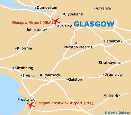
Glasgow Prestwick Airport (PIK)
Orientation and Maps
(Glasgow, Scotland)
The country's largest city, Glasgow stands next to the meandering River Clyde and is densely populated. Glasgow is located in the west central area of the Scottish Lowlands and features many enticing, revamped areas along the waterfront, where restaurants, bars and pubs abound.
Located next to Ayr and on the southwestern outskirts of the city, Glasgow Prestwick Airport (PIK) is just minutes from mainland Scotland's western coastline. The airport is easy to reach from Glasgow city centre, with the A77 / M77 being the fastest and most direct route.
Glasgow Prestwick Airport (PIK) Maps: Important City Districts
Glasgow is home to numerous neighbourhoods, although the city centre is where most people head. Here you will find an organised network of roads, with the area being bordered to the east by High Street. On the western side of central Glasgow, the M8 motorway is a prominent boundary, with the River Clyde lying directly south. Amongst the main highlights in this part of the city are several major shopping centres, such as the Buchanan Galleries and also the nearby St. Enoch Centre.
To the east of central Glasgow you will find Merchant City, a prosperous district with an important industrial past. Merchant City is also known for its burgeoning arts scene and gay community. Other important parts of the city include the Financial District, the West End, the East End, and the South Side - home of the Glasgow Science Centre, Springfield Quay and the enormous Pollok Country Park.
United Kingdom Map

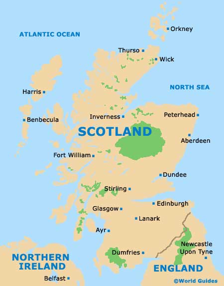
Scotland Map
Glasgow Map